

 More from my trip to Orange County, this time at the throne of consumersim *gasp* a mall. They have the Gap and Hot Dog on a Stick, and hey look! They have good design too!
This is a pedestrian bridge built in 2000 connecting two parts of a large shopping mall designed by a collaborative team of Kathryn Gustafson (Gustafson Guthrie Nichol), Ellerbe Becket and Anderson & Ray.
It is an interesting solution to a utilitarian need; a pedestrian connection across a parking lot and busy street, and the mediation of a change in elevation. The bridge is called the "Bridge of Gardens," a ridiculous name probably dreamed up by the mall, but that name does at least hint towards the marriage of landscape, engineering and architecture.
I have seen this published before, but never with more than a couple small images... so check it out... I went overboard on the pics just for you.
Firm: Gustafson Guthrie Nichol - Landscape Architecture / Art
Firm: Ellerbe Becket - Architecture
Firm: Charles Anderson (formerly of Anderson & Ray) - Landscape Architecture
Firm: HNTB - Structural Engineering
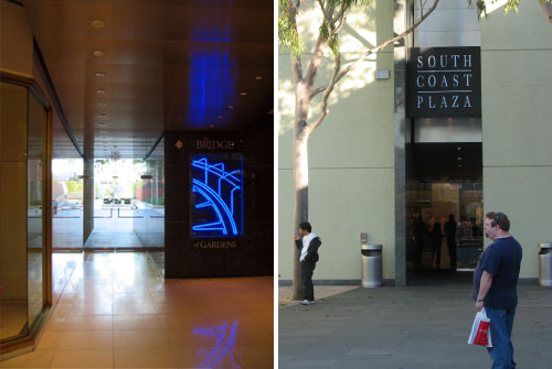
Link: South Coast Plaza
The photos are placed in order from east to west.
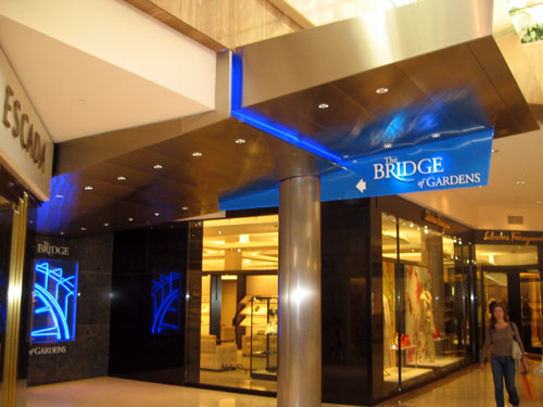
And upward lifting arc of stainless steel with blue neon marks location of the bridge from inside the eastern portion of the mall.
The entry/exit is a narrow slot in the shell of the building. An existing (and not interesting) entry to Macy's department store is perpendicular to this entry, to the right in the right hand photo).
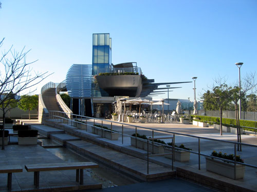
The exterior plaza at the east end is called the "Strata Garden" and provides a transitional area in what used to be an entry from the parking lot into Macy's. A cafe is tucked beneath the end of the bridge providing a nice programmed space on the plaza.
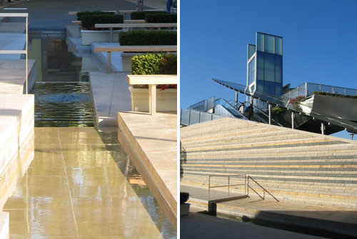
The Strata Garden is meant to "represents the transformation of the site over time, from arid land, to agricultural fields, to present day development."
The principal garden components are stone and water. Stone in planar surfaces represents movement. Water rising from bubbling pools cuts through the rock strata. Stone terraces express the intersection of human and the geologic time scales. Crossing and overlapping, light on dark—uplift and lightness resting on stability, then dark on light—heavy pressure weighing down the light, constraining it, preventing release.
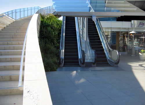
An arcing stone stairway wraps up from the garden to the bridge, dissolving into steel and glass. The escalators are covered with a glass canopy lit with blue neon. The ground plane wraps up alongside the stairway and slides under the escalators and onto the roof of the cafe.
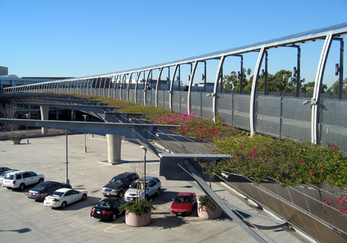
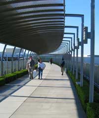
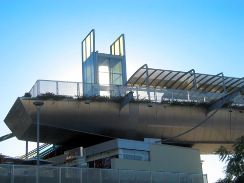
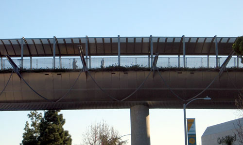
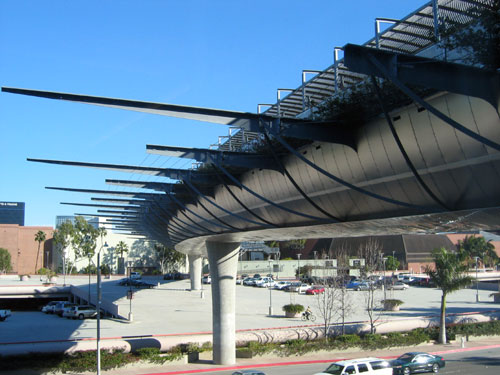
The bridge curves in a wide radius along its 600 foot length over streets and parking lots. The plane of the bridge surface is extended by means of varying lengths of tapered steel between which cables are strung. Bougainvillea vines spread out from the bridge. This combination of steel and planting creates a spacious feeling platform that dissolves into air.
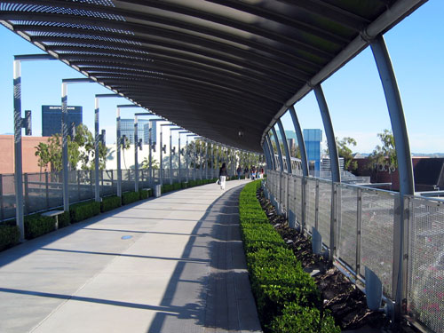
The elevated walkway is lined with boxwood and bougainvillea. An arcing canopy of stainless and galvanized steel partially covers the bridge.
The bridge is a surprisingly comfortable space despite the height and traffic below.
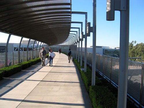
Looking from the west end towards the east.
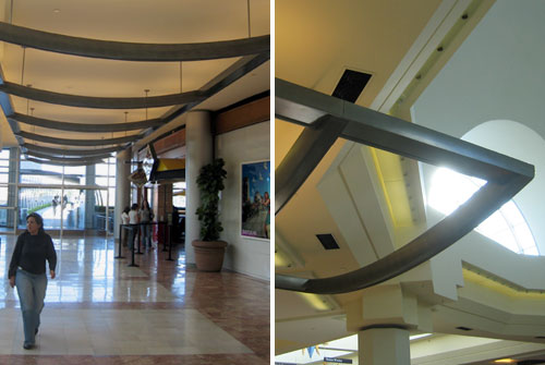
The east end of the bridge emerged directly out of the glass facade on the third level of the western mall building. A bowed steel armature slides from the bridge to the central space of the mall at an angle to the mall's rectilinear grid to serve as a marker. The flooring also matches this geometry. Strangely, this element does not other feature the blue neon, signage or any other thematic device used elsewhere, and I wonder if most people even notice it or understand that it is connected to the bridge.
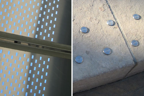
A close up of the perforated stainless steel canopy (left) is another "dissolving" device. A very nice detail of stainless steel studs marks the edges of each stair tread (right).
View Land+Living Maps in a larger map